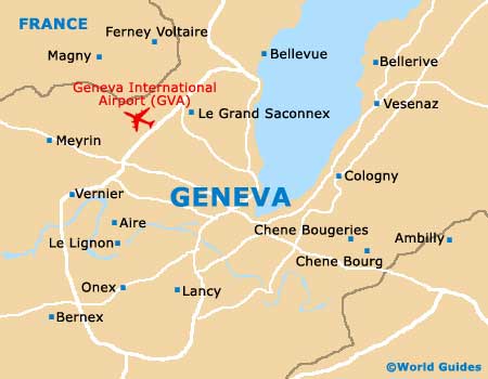
Geneva International Airport (GVA)
City Orientation and Maps
(Geneva, Switzerland)
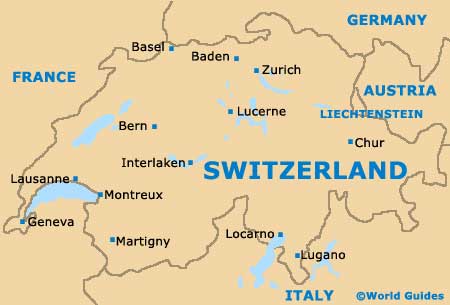
The third-biggest city in the whole of Switzerland, Geneva enjoys a lakeside location and features a true international feel. Known for being home to the headquarters of the United Nations (UN), Geneva is well-placed for those looking to explore both the Swiss Alps and also the nearby French Alps. Geneva is located close to France, with Lyon, Saint-Etienne and Grenoble all within driving distance, being located to the south-west.
On the north-western side of the city, Geneva International Airport (GVA) is an important transport hub and connects all major European cities to Switzerland, together with many international locals. The airport is known locally as the 'Aéroport International de Genève'.
Geneva International Airport (GVA) Maps: Important City Districts
Geneva is located on the south-western side of Lake Geneva (Lac de Genève). The heart of the city centre lies alongside the lake's shore and is divided by the River Rhone, which eventually becomes the Arve River.
Those travelling into Geneva by train will arrive at the Gare de Cornavin station, located on the northern side of the river, or at the Gare des Eaux-Vives SNCF station to the east. Located in the southern region of Geneva you will find the Old Town area (Vieille Ville), which is well pedestrianised and based around the Grand Rue, a prominent thoroughfare.
During the summer months, the most striking landmark in Geneva is without a doubt the Jet d'Eau, an enormous fountain alongside a pier on the lake's southern shore.
Switzerland Map
Geneva Map